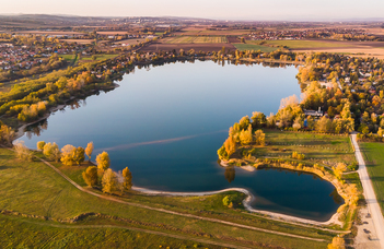
Surveying of Lake Mályi

The quarry lake of 84 acres (0.34 km2) area in the village of Mályi has particular importance for local tourism, and this lake is used for fishing, diving, and bathing. The condition of the lake is in our interest, as mining used to take place in the area, and now clayey mounds of varying size and distribution can be found on the bottom of the lake. These phenomena and their positions could be determined by aquatic geophysical surveys. Another problem connected to the current state of the lake is the increasing siltation. This process is threatening the ecosystem of the lake, spatial distribution of the thickness of the silt is needed to plan an efficient lakebed dredging.
The survey of the lake will be carried out with aquatic seismic, aquatic geoelectric, and water radar measurements, for which the instruments will be provided by Geomega Ltd. The silt will also be sampled for a full survey.
